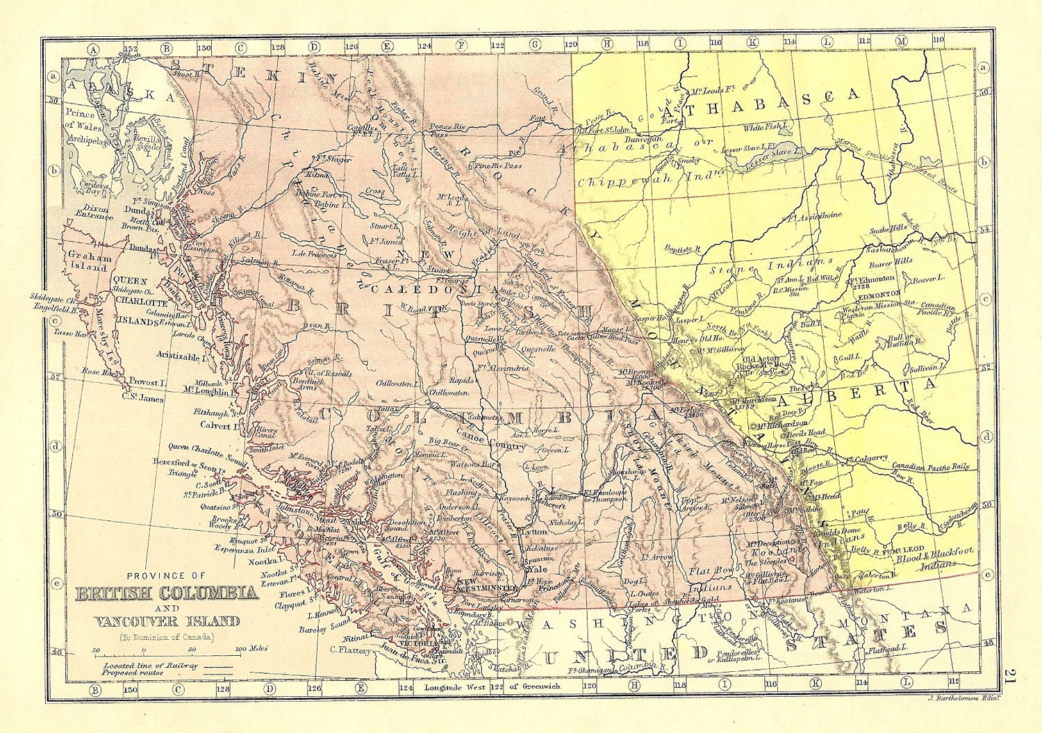
Colour printed antique map of British Columbia Vancouver Island, Canada. Published 1883 in ‘Atlas of the British Empire throughout the World,’ by John Bartholomew, F.R.G.S. Approx size 6×8.5ins.
This site is protected by reCAPTCHA and the Google Privacy Policy and Terms of Service apply.